
KIMBERLEY DUGONG SURVEY
High-resolution, georeferenced aerial imagery for dugong and marine-megafauna research.
- Client
- Nyamba Buru Yawuru / ISWAG
- Location
- Kimberley coast, Western Australia
- Period / status
- 2026 survey complete
Survey scope
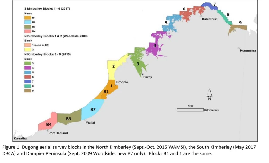
A large-scale aerial photogrammetry survey along the Kimberley coastline to acquire high-resolution, georeferenced digital imagery suitable for identification of dugongs and other marine megafauna, abundance estimation, spatial analysis and comparison with earlier surveys.
The imaging workflow links photographs to camera and navigation records, image metadata, flight paths and image footprints. The survey spans the Dampier Peninsula, North Kimberley and South Kimberley regions.
Data and deliverables
- Georeferenced JPEG imagery
- Archived RAW files
- Image-level metadata
- Flight-path lines and image-footprint polygons
 View image +
Contact AeroGlobe
Ask a question or request a quote for aerial survey, mapping or environmental analysis.